


Description
DJI PHANTOM 4 RTK
Visionary Intelligence. Elevated Accuracy.
The DJI Phantom 4 RTK is equipped with a 20-megapixel camera that can capture high-resolution aerial images with great detail. It also features a TimeSync system that aligns the flight controller, camera, and RTK module to ensure that the data captured is accurate and reliable. This makes it an ideal tool for creating high-quality maps, 3D models, and other data products.
The Phantom 4 RTK is also designed to be easy to use. It features a range of intelligent flight modes that can help you capture the data you need quickly and efficiently.
Upgrade your next mapping mission with the Phantom 4 RTK – the most compact and accurate low altitude mapping solution.
Centimeter-Level Positioning System
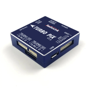
A new RTK module is integrated directly into the Phantom 4 RTK, providing real-time, centimeter-level positioning data for improved absolute accuracy on image metadata. In addition to optimized flight safety and precise data collection, the Phantom 4 RTK stores satellite observation data to be used for Post Processed Kinematics (PPK), which can be conducted using DJI Cloud PPK Service . Fit the Phantom 4 RTK to any workflow, with the ability to connect this positioning system to the D-RTK 2 High Precision GNSS Mobile Station, or NTRIP (Network Transport of RTCM via Internet Protocol) using a 4G dongle or WiFi hotspot.
Gather Accurate Data with TimeSync
To take full advantage of the Phantom 4 RTK’s positioning modules, the new TimeSync system was created to continually align the flight controller, camera and RTK module. Additionally, TimeSync ensures each photo uses the most accurate metadata and fixes the positioning data to optical center of the lens – optimizing the results from photogrammetric methods and letting the image achieve centimeter-level positioning data.
Precise Imaging System
Capture the best image data with a 1-inch, 20-megapixel CMOS sensor. Mechanical shutter makes mapping missions or regular data capture seamless as the Phantom 4 RTK can move while taking pictures without the risk of rolling shutter blur. Due to the high resolution, the Phantom 4 RTK can achieve a ground sample distance (GSD) of 2.74 cm at 100 meters flight altitude.To ensure each Phantom 4 RTK offers unparalleled accuracy, every single camera lens goes through a rigorous calibration process, with parameters saved into each image’s metadata, letting post-processing software adjust uniquely for every user.
Purpose-Built Flight Planning Application
A new DJI GS RTK app and Remote Controller with built-in screen, giving users a streamlined control scheme for surveying missions and other data acquisition scenarios.The GS RTK app allows pilots to intelligently control their Phantom 4 RTK, with multiple planning modes, including Photogrammetry (2D and 3D), Waypoint Flight, Terrain Awareness, Block Segmentation , and more. Users can also import KML/KMZ files to optimize the workflow for their missions.With the built-in screen, pilots can clearly view and plan their missions on an ultra-bright, 5.5-inch HD display.
Access a Variety of 3rd Party Applications
Pilots with experience using 3rd party apps on DJI drones can access the world’s leading drone app ecosystem for their Phantom 4 RTK with the SDK Remote Controller. Users can plug in a compatible Android or iOS device and install any compatible DJI Mobile SDK-enabled app to harness the full power of their Phantom 4 RTK.
OcuSync Transmission System
Enjoy stable and reliable HD image and video transmission at distances of up to 7 km, great for mapping larger sites.
Seamless Compatibility with D-RTK 2 Mobile Station
Support your Phantom 4 RTK missions with the D-RTK 2 Mobile Station – providing real-time differential data to the drone and forming an accurate surveying solution, or acquire accurate location coordinates when used as an RTK rover. The Mobile Station’s rugged design and OcuSync transmission system ensures you can gain centimeter-level accurate data with your Phantom 4 RTK in any condition.
Start Mapping Today
With a built-in flight planning app (GS RTK) and an easy method to collect RTK data (RTK Network or D-RTK 2 Mobile Station), pilots have a full solution for any surveying, mapping or inspection workflow – right out of the box.
Specifications of DJI PHANTOM 4 RTK
-
Takeoff Weight
-
1391 g
-
Diagonal Distance
-
350 mm
-
Max Service Ceiling Above Sea Level
-
19685 ft (6000 m)
-
Max Ascent Speed
-
6 m/s (automatic flight); 5 m/s (manual control)
-
Max Descent Speed
-
3 m/s
-
Max Speed
-
31 mph (50 kph)(P-mode)
36 mph (58 kph)(A-mode)
-
Max Flight Time
-
Approx. 30 minutes
-
Operating Temperature Range
-
32° to 104° F (0° to 40℃)
-
Operating Frequency
-
2.400 GHz to 2.483 GHz (Europe, Japan, Korea)
5.725 GHz to 5.850 GHz (United States, China)
-
Transmission Power (EIRP)
-
2.4 GHz
CE (Europe) / MIC (Japan) / KCC (Korea) :< 20 dBm5.8 GHz
SRRC(China) / FCC(United States)/NCC(Taiwan,China):< 26 dBm
-
Hover Accuracy Range
-
RTK enabled and functioning properly:
Vertical:±0.1 m;Horizontal:±0.1 mRTK disabled
Vertical:±0.1 m(with vision positioning );
±0.5 m(with GNSS positioning)
Horizontal:±0.3 m(with vision positioning);
±1.5 m(with GNSS positioning)
-
Image Position Offset
-
The position of the camera center is relative to the phase center of the onboard D-RTK antenna under the aircraft body’s axis:(36, 0, and 192 mm) already applied to the image coordinates in Exif data. The positive x, y, and z axes of the aircraft body point to the forward, rightward, and downward of the aircraft, respectively.
-
Single-Frequency, High-Sensitivity GNSS Module
-
GPS+BeiDou+Galileo(Asia);
GPS+GLONASS+Galileo(other regions)
-
Multi-Frequency Multi-System High-Precision RTK GNSS
-
Frequency Used:
GPS:L1/L2;
GLONASS:L1/L2;
BeiDou:B1/B2;
Galileo:E1/E5aFirst-Fixed Time:< 50 sPositioning Accuracy: Vertical 1.5 cm + 1 ppm(RMS);
Horizontal 1 cm + 1 ppm(RMS)
1 ppm means the error has a 1mm increase for every 1 km of movement from the aircraft.
-
Mapping Accuracy **
-
Mapping accuracy meets the requirements of the ASPRS Accuracy Standards for Digital Orthophotos Class Ⅲ
** The actual accuracy depends on surrounding lighting and patterns, aircraft altitude, mapping software used, and other factors when shooting.
-
Ground Sample Distance(GSD)
-
(H/36.5) cm/pixel,
H means the aircraft altitude relative to shooting scene (unit: m)
-
Data Acquisition Efficiency
-
Max operating area of approx. 1 km² for a single flight(at an altitude of 182 m, i.e., GSD is approx. 5 cm/pixel, meeting the requirements of the ASPRS Accuracy Standards for Digital Orthophotos Class Ⅲ
-
Stabilization
-
3-axis (tilt, roll, yaw)
-
Pitch
-
-90° to +30°
-
Max Controllable Angular Speed
-
90°/s
-
Angular Vibration Range
-
±0.02°
-
Velocity Range
-
≤31 mph(50 kph) at 6.6 ft(2 m) above ground with adequate lighting
-
Altitude Range
-
0-33 ft(0 – 10 m)
-
Operating Range
-
0-33 ft(0 – 10 m)
-
Obstacle Sensing Range
-
2-98 ft(0.7-30 m)
-
FOV
-
Forward/Rear: 60° (horizontal), ±27° (vertical)
Downward: 70° (front and rear), 50° (left and right)
-
Measuring Frequency
-
Forward/Rear:10 Hz;
Downward: 20 Hz
-
Operating Environment
-
Surfaces with clear patterns and adequate lighting(> 15 lux)
-
Obstacle Sensing Range
-
0.6-23 ft(0.2 – 7 m)
-
FOV
-
70°(Horizontal)
±10°(Vertical)
-
Measuring Frequency
-
10 Hz
-
Operating Environment
-
Surface with diffuse reflection material, and reflectivity> 8%(such as wall,trees, humans, etc.)
-
Sensor
-
1″ CMOS; Effective pixels: 20 M
-
Lens
-
FOV 84°;8.8 mm / 24 mm(35 mm format equivalent:24 mm);
f/2.8 – f/11, auto focus at 1 m – ∞
-
ISO Range
-
Video:100-3200(Auto)
100-6400(Manual);Photo:100-3200(Auto)
100-12800(Manual)
-
Mechanical Shutter Speed
-
8 – 1/2000 s
-
Electronic Shutter Speed
-
8 – 1/8000 s
-
Max Image Size
-
4864×3648(4:3);
5472×3648(3:2)
-
Video Recording Modes
-
H.264,4K:3840×2160 30p
-
Photo Format
-
JPEG
-
Video Format
-
MOV
-
Supported File Systems
-
FAT32(≤ 32 GB);
exFAT(> 32 GB)
-
Supported SD Cards
-
MicroSD, Max Capacity: 128 GB. Class 10 or UHS-1 rating required Write speed≥15 MB/s
-
Operating Temperature Range
-
32° to 104° F (0° to 40℃)
Check our wide range of DJI Drones – Click Here
Reviews
There are no reviews yet.